Making sense of coastal erosion
The east coast of England is being washed away. Tidal currents sweeping down from the north are gradually eroding the coast from Flamborough Head south to Suffolk, moving shingle and silt down into long narrow spits as at Spurn Head and Orford Ness, collapsing the shingle banks in front of the wetland reserves of Cley and Minsmere and eroding the soft sandy cliffs of Dunwich. Accelerated by high tides and strong winds, the topography is changing. Acres of agricultural land are threatened along with scores of coastal communities.
To some extent, the erosion is predictable. Computer models can factor in tides, currents, geology, bathymetry, and they provide an rough idea, but what actually happens often depends on politics and local interests. As, my brother Simon, who is an artist interested in environmental issues, told me, ‘The situation is very different on the impoverished Holderness and Lincolnshire Coastline compared with the more affluent Suffolk Coast where there are major amenities like a nuclear power station, a world famous nature reserve and big coastal communities of Lowestoft, Southwold, Aldeburgh and Felixstowe.’ Down there, the coast is being protected by blocks of Norwegian granite and sand dredged up just off shore, but such measures are short term solutions. Over the longer term, usch measures are counterproductive. The granite blocks can sink and the tides find their way round the back of them while dredging offshore sandbanks can remove the first bulwark against erosion.
‘What the land means varies from place to place’, Simon explained. ‘Such meanings are political and local and their cumulative effect cannot be easily factored in. Decisions on whether to allow arable or to allow the river to break through to the sea (as at Aldeburgh) are often made by local councils without reference to the bigger picture. So what you can have is some local amenities protected, a golf club here, a ferry terminal there at the expense of desolation at bigger areas up and down the coast.’
As an artist without the restrictions of commerce and local politics, Simon is free to use his imagination to create what might happen in the future. He is not confined by the physical constructs of the computer modellers, he can bring in concepts of politics and meaning to gain a more realistic understanding of what might happen. It’s a chaotic system but like the weather, not entirely unpredictable.
Not for the first time, have I seen comparisons between what Simon is doing and what I am interested in. We think about things the same way. Most illness is more influenced by the meaning of what happens to an individual; diet, infection, gender, contamination may be able to be factored in but are only part of the story. For both coast and the disease host, you need to get up front and personal.
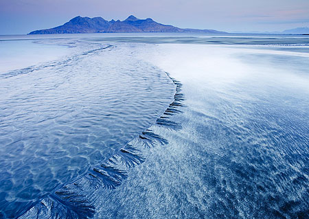
The image, Sand patterns, Isle of Eigg, by Dudley Williams was the winner of the classic view, adult class, in this years Landscape Photographer off the Year competition.
Published on:
December 28, 2010